
As Hurricane Ian made landfall on Florida’s west coast Wednesday afternoon, officials in Georgia’s state and county governments are also not taking any chances.
This story continues below.
Tuesday afternoon, Gov. Brian Kemp declared a state of emergency to prepare for the storm’s impact in Georgia. Up to 500 National Guard troops could be deployed, according to the executive order.
The state of emergency will go into effect at 7 a.m. on Thursday, Sept. 29, and expire at midnight on Friday, Oct. 28.
The Georgia Emergency Management and Homeland Security Agency “has teams standing by to deploy to affected counties,” Kemp’s office said.
In preparation for the inclement weather, Dawson County Fire and Emergency Services personnel have been fueling up its generators and chainsaws, said Chief Troy Leist.
“If it was going to come up through the center of the state [rather than the east], we’d be having a much different discussion,” Leist added.
Public Works Director Jeff Hahn said in an email that Road Department crews will be on call throughout the storm event to assist as needed.
Forecast
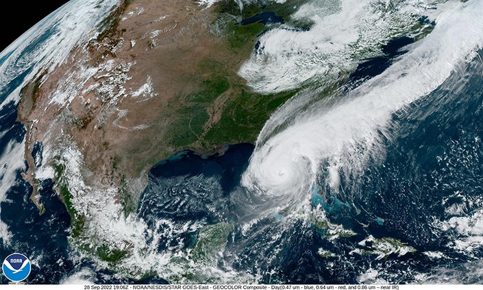
At about 3:05 p.m. Wednesday, Hurricane Ian made landfall near Cayo Costa on Florida's Gulf Coast with winds of about 150 mph, according to the National Hurricane Center.
By Wednesday morning, the storm had reached Category 4 strength with estimated 155 mph winds, almost Category 5 strength, Associated Press previously reported.
The storm previously reformed its eyewall and gained strength over the Gulf of Mexico, hitting western Cuba as a Category 3 Tuesday with 125 mph winds, taking out power for all 11 million of the island’s people, AP stated.
The hurricane is predicted to weaken into a tropical storm and then a depression going into the weekend. Heavy rains and wind gusts are predicted in Georgia starting Thursday through Saturday, according to the National Weather Service's 3 p.m. update Wednesday.
Across much of northern and central Georgia, NWS predicted wind gusts of 30+mph and heavy rainfall between 1-4 inches as the "primary hazards" as what remains of the storm passes over the region.
People across the state may experience downed trees, resulting power outages and/or localized flash flooding.
DCN is a sibling publication of The Gainesville Times and Forsyth County News.